

| Welcome to the Wasilla Main Street Rehabilitation project website! |
|---|
Project Introduction
Project Purpose & Need
|
The Alaska Department of Transportation and Public Facilities (DOT&PF), in cooperation with theFederal Highway Administration (FHWA), proposes to improve mobility by reconstructing Main Street and nearby roadways in downtown Wasilla. FHWA approved the Final Environmental Assessment and signed a Finding of No Significant Impact (FONSI) in December 2013.
Project Overview 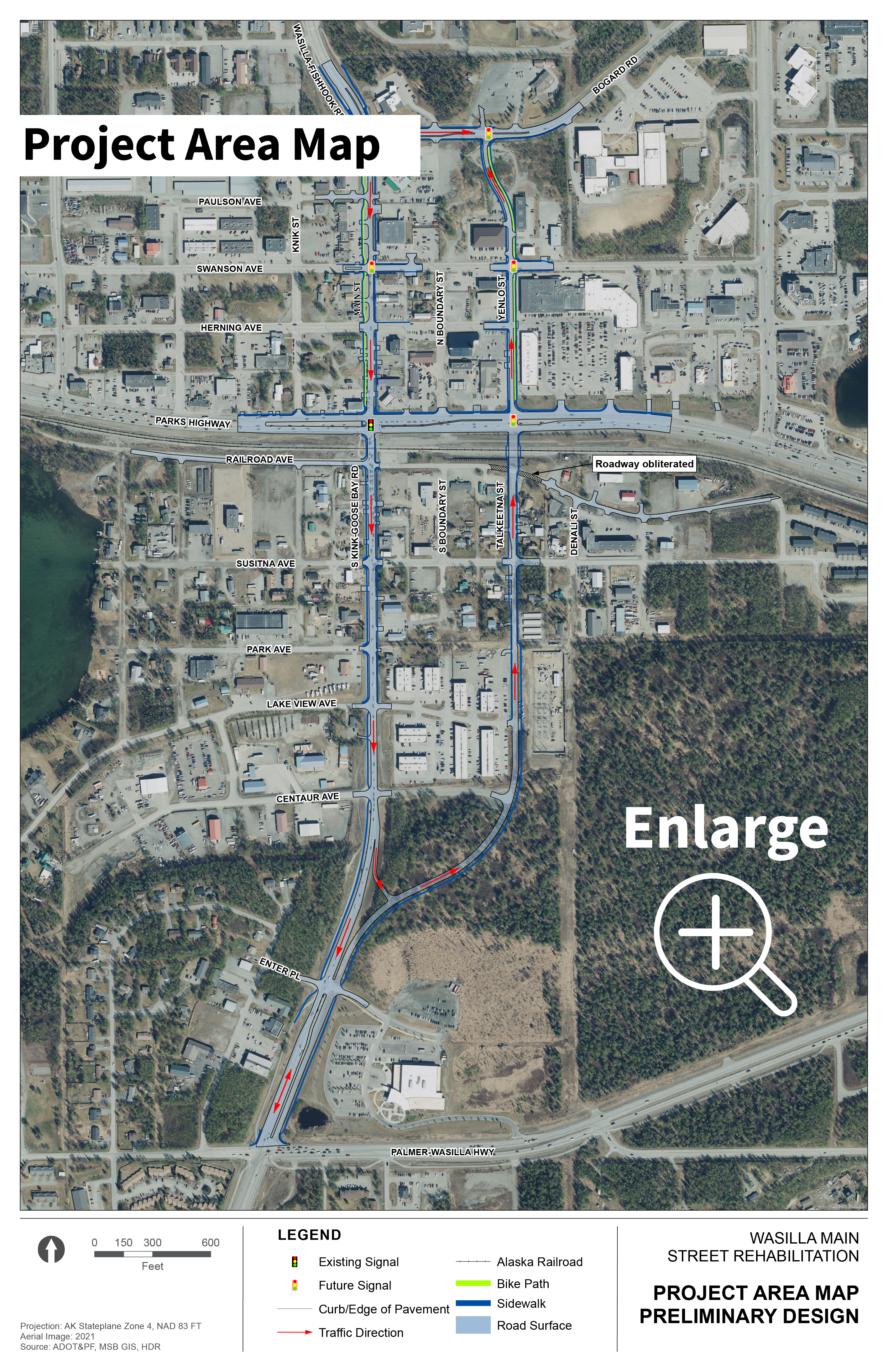
The project team is moving forward with design on the preferred alternative established in the Environmental Assessment phase of the project.
The proposed design will construct a one-way couplet to improve north-south traffic flow within Wasilla's historic town center. Main Street and Knik-Goose Bay (KGB) Road will service southbound traffic, while improvements and new extensions of Talkeetna and Yenlo Streets will serve northbound traffic. The northern project boundary will be Bogard Road, and the Palmer Wasilla Highway will be the southern boundary. Additional work includes enhancements to intersections, drainage, and pedestrian/bicycle facilities. Improvements will also be made to the Parks Highway within the project area, with a new at-grade intersection at Yenlo/Talkeetna Street.
Since the environmental document was approved in late 2013, DOT&PF has completed “Plans-in-Hand” or 65% design and is moving ahead to complete the 95% design. DOT&PF has begun the appraisal and acquisition process for right of way (ROW).
85-90% Design Plans are available on the Project Documents Page.
Project Information
The environmental review, consultation, and other actions required by applicable Federal environmental laws for this project are being, or have been carried out by DOT&PF pursuant to 23 U.S.C. 327 and a Memorandum of Understanding dated November 3, 2017, and executed by FHWA and DOT&PF.